Ladakh Tour... dream destination....: My dream Destination...Ladakh....: Ladakh....it is in my dream for a long long period. Many of my friends visited this beautiful place and I heard just stories from the...
Tuesday, October 14, 2014
Monday, September 15, 2014
My dream Destination...Ladakh....
We reached Srinagar by flight and stayed there overnight. Early next morning we started to reach Kargil by the end of the day.Our tour operator informed it will be journey of about 9 hours. We crossed river Sindh and stopped for breakfast at the picturesque spot in Ganderbal district with back drop of the river and the bridge.

 |
| river Sindh at Sonmarg |
 |
| Sindh @ Sonmarg |


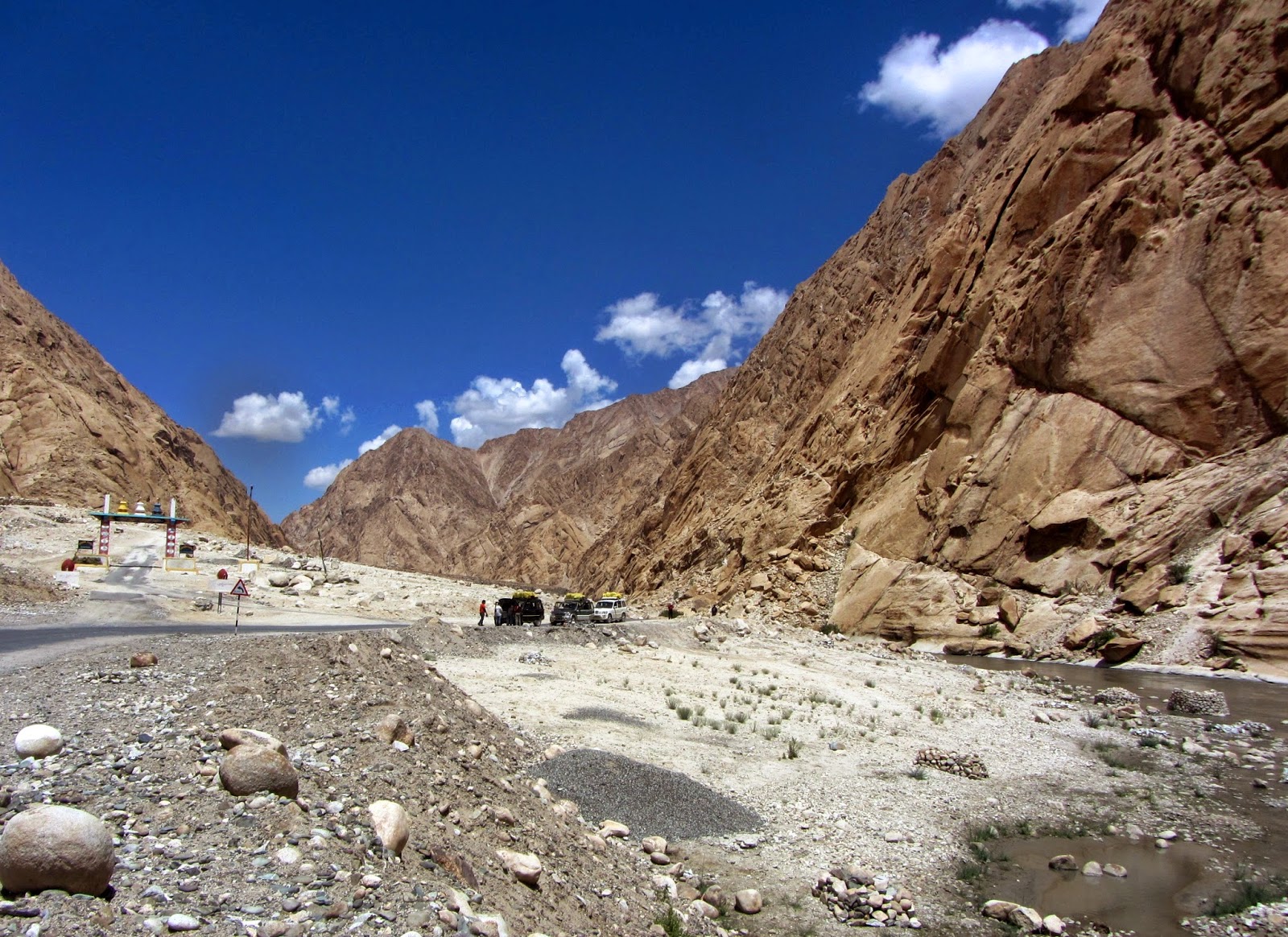
As we proceeded furhter ahead and went on climbing higher and higher towards Joji La (the pass at an altutide of ~11600ft) the sceneries changed slowly from more green to more rocky. Joji La is 9km from Sonmarg. But we took much longer to reach because of a nasty traffic snarl as we neared the Pass. Due to some landslide the road got closed and the caterpillar of BRO is found to working on it to remove it for smooth traffic movement. BRO maintains this whole route and does an excellent tireless job to maintain the road in servicable condition for both military and public. This is the only link of ladakh cvalley with the Kashmir and the rest of India and remains out of bound of traffic because of heavy snow fall during winter and remains closed from November to May. This pass was taken over by Pakistan army during 1948 to capture Ladakh from India. And India by operation Bison recaptured the same by using Tanks for the first time in such a high altitude.
I became quite emotional and romantic when I remebered that this is the Pass through which Alexander the Great, Megasthenis the historian, Fa Hien the Budhist Monk and many more such illustrious persons arrived in India from time immemorial. History is such a facsinating subject and I n
 |
| Crossing Joji La |
 |
| Traffic jam at Joji La |
 |
| glacier @ Joji La |


We reached Drass are where the fierce battle of Kargil war actually took place. Its huge grass land area with only hamlets of shepherds and villages are far off almost not visible with naked eyes. it became quite clear how the enemies stealthily entered and occupied a huge area, the military bunkers etc with so much ease in winter. and it also became quite clear why the information reached to Indian Authorities only through the shepherds for whom this is a natural place for living. We saw the Tolloling peak in the back ground of the war memorial built and was thrilled to know that the LOC lies just in the opossite side of that peak! We also saw the highest peak of this area The Tiger Hill which was occupied by Pakistani army and the fiercest battle took place there to snatch the region from the foreign invason!

The Tiger Hill top seen @ far end...Drass
 |
| Vijay path..the Kargil war memorial @Drass...Tolloling is seen behind! |
 |
| Maitreya Budhha @Mulbek |
 |
| Mulbek Monastery |
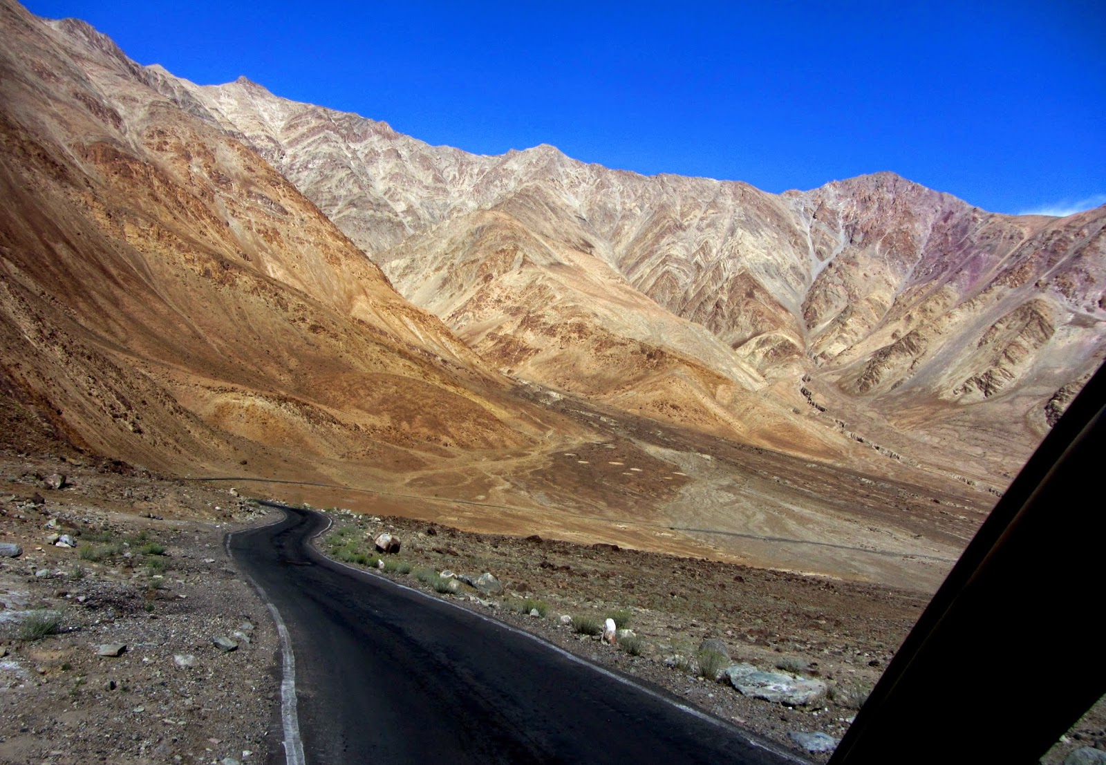
We rode further ahead goes on up and up to reach the Pass Namik La (12200 ft) and then to the top most point of this route at Fotu La.I felt like I'm on the top of the world! The passes are so windy I felt I shall be airborne! By this time the vegetation vanished completely and the mountains all around are showing beautifull magical colours of red, yellow, purple and different shades of grey. The structures of the mountains are also very different from the ones we are used to see at other Himalayan ranges.

Fotula Top....the highest point in Leh Srinagar High way...
 |
From this point there is a sharp down hill journey along the famous Langroo Loops.We didn't see any sign of human habitation along very long stretches and this is the uniqueness of Ladakh region! I wish it remains so and the invasion of hordes of tourists does not make this place go astray like all other beautiful places! Its good that its so difficult to reach there.
Our next place of interest was Lamayuru and the famous monastery. The rock structure at this region is so unique that it looks like lunar terrain and hence the name "MOONLAND". There are deep gorges and hollow stone structures! The monastory is the oldest one in this region.
We took a break for a very late lunch at one of the way side dhabas crossing Lamayuru beside the river Suru at a picturesque unknown place.
 |
| Lamayuru Monastory |

The spot where we had our lunch...nameless but picture perfect!!!
 |
River Indus near Uletokpo
@Uletokpo
  Srinagar- Leh high way in between Uletokpo & Nimmu After seeing the beautiful confluence of Zanskar and Indus at Nimmu we saw the wonder spot of magnetic hill where your car even when in neutral gear moves backward with apparently no gradient in the road! Next stop was Patthar Sahib, the Gurdwara of Guru Nanak Saheb an encient one. We enjoyed the warm tea with savouries offered at the gurudwara along with pure ghee halwa happily. Here the young guy offerring tea is actually a young army Jawan posted at Drass. He is doing KAR SEVA by taking leave from his duty for one week! I'm always facinated by this beautiful custom of voluntary community service of the Sikhs where you can feel so much your usefulness and bonding with your own poeple. Its such a nice tradition. We all cleaned our utensils and started again. By this time it was completly dark out side. |
.JPG) |
| River Indus @the confluence |
 |
| Confluence of Indus & Zanskar rivers @ Nimmu |
By the time we reached Leh it was quiet late in the evening. The next day we stayed at our Hotel Himalaya in Leh. In the afternoon visited Leh Palace and Shanti Stupa. Leh Palace is made in the style of Potala Palace of Lhasa in Tibbet! I walked uphill through the market and densely populated living quarters of local people to reach the Palace. You can see the whole town from there. Next went to Shanti Stupa about 5km away again on a hill top and the whole surrounding can be seen beautifully from there! The mountains around appeared to be made of loose mud and the colour of the same is very similar! So it is no wonder that when cloud burst happened in 2010 summer the whole town was submerged in mud deluge. I have never seen or imagined mountains can look like this.
.JPG)
.JPG)
 |
| view from Shanti Stupa |

Shanti Stupa
Our next destination is Nubra Valley via Khardungla Pass (18400 ft) allegedly the highest motorable road of the world (debatable!) on the following day (9th August). As the road passed the outskirt of Leh we saw Shanti Stupa again from far and the road slowly went upwards in every bend of the mountain. It's a long and hazardous journey with regular military convoys and traffic jams being a routine in this route! The road condition is also quite bad with constant land slide of the loose stone structure. Though BRO works tirelessly in all the routes of Ladakh to keep the road safe and motorable for both public and military but still the road condition in long stretches here is in very poor shape.
The most common perceptions of the tourists are that to reach the destination as hurriedly as possible. But if you do it in Ladakh you will miss almost most of the charms of the place! Since the beauty of this region lies everywhere in the landscape itself......it opens up like magic before your eyes! It changes from place to place. We stopped at many places during our journey to different destinations and got soaked in the beauty and uniqueness.
We got entangled in a nasty traffic snarl just before Khardungla Pass. We heard so many things about altitude sickness before coming here and this spot is naturally the most dreaded being the heighest point of our whole Ladakh Tour. Though the claim of it being the heighest motorable road in the World written at many places of Khardungla Pass by BRO and military is actually no more a reality since there are at least two more such roads in Tibet and China! But fortunately none in the group had fallen sick to any great degree to need any medical intervention. The thing which made me very uncomfortable and almost sick was the smell of partly burnt fuel coming out of the stationery vehicles mainly the the goods trucks and military convoys. Because of high altitude the vehicles have to keep the engines running though we got struck there well over half an hour! You can get tea and other eatables as well as souvenirs at the army canteen at Khardungla. Here it is written in bold letters that one should not stop there for more than twenty minutes since that may cause permanent health hazard because of very little oxygen in the air. I have already told that we were forced to stay about an hour there but fortunately nothing went wrong! We saw two glaciers at Khardungla and like all other passes it was very windy. At this time of the year there was no snow but in general you will find snow here at almost round the year.
 |
way to Khardungla....Leh valley is seen below   |
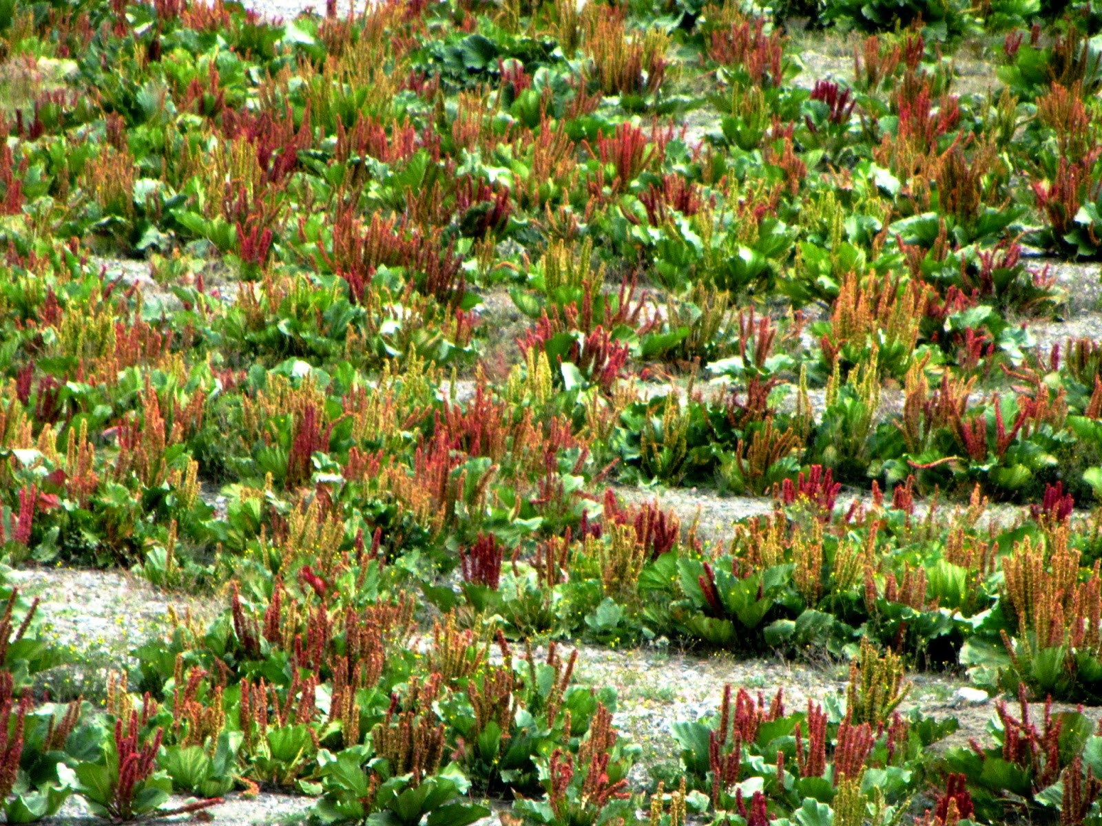
We saw beautiful flourescent blue wild flowers in abundance in the rocky mountain side! It appeared so fascinating in that absolutely barren and dry landscape.

We reached North Pullu after Khardugla (16000 ft, 14 km) and had our luch there. South and North Pullu flank khardungla Pass in the two sides and one has to get inner line permit to visit the Pass from these two places. The scenery changed somewhat with wide grasslands along some small springs and rivultes running down from different glaciers and yaks are found to graze at many places.

North Pullu

Yaks


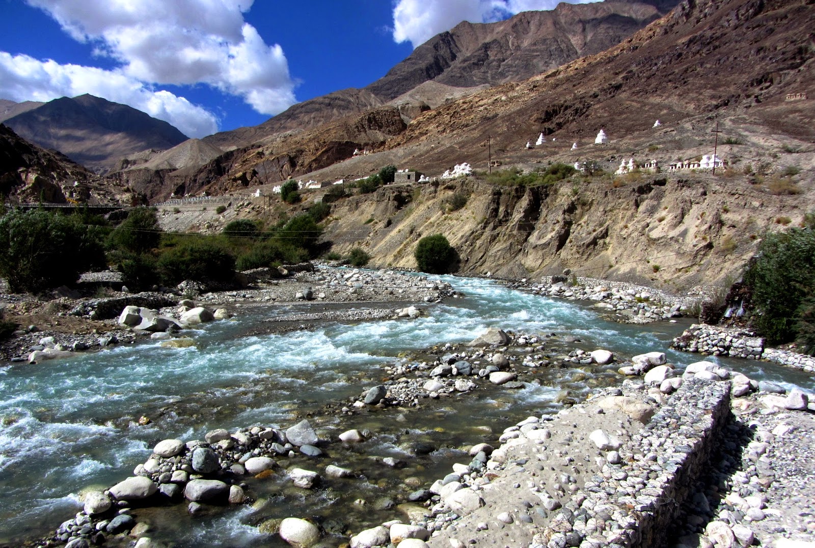
Shyok river- first glimpse
 |
| Shyok River n Karakorum Range |
From North Pullu we proceeded further ahead.After some time we got the first glimpse of the Shyok river, a huge river flowing Northwards which made me so confused since right from childhood I'm used to see only South bound great rivers because of the position of Himalaya mountain. The Shyok River, a tributary of the Indus, originates from the Rimo Glacier, one of the tongues of Siachen Glacier. The river widens at the confluence with the Nubra River. The alignment of the Shyok river is very unusual, originating from the Rimo glacier, it flows in a southeasterly direction and, joining the Pangong range, it takes a northwestern turn, flowing parallel to its previous path. The Shyok flows in a wide valley, suddenly entering a narrow gorge afterChalunka, continuing through Turtuk and Tyakshi before crossing into Pakistan. The Shyok joins the Indus at Keris, to the east of the town of Skardu. The Nubra river, originating from the Siachen glacier, also behaves like the Shyok. Before Tirit the SE flowing river Nubra takes a NW turn on meeting the river Shyok. The similarity in the courses of these two important rivers probably indicates a series of paleo fault lines trending NW-SE in delimiting the upper courses of the rivers. The importance of the Indus and the Shyok rivers is in the deposition of the thick quaternery sediments—a treasure trove for geology researchers.
 |
| Karakorum Range beside Shyok River |
 |
Way to diskit, Nubra Valley beside Shyok River and through Karakorum Range Seabuckthorn berries, Nubra valley, Ladakh |
 | ||||||
Strange rock formations of Karakorum range
Diskit monastory @Diskit, Nubra Valley
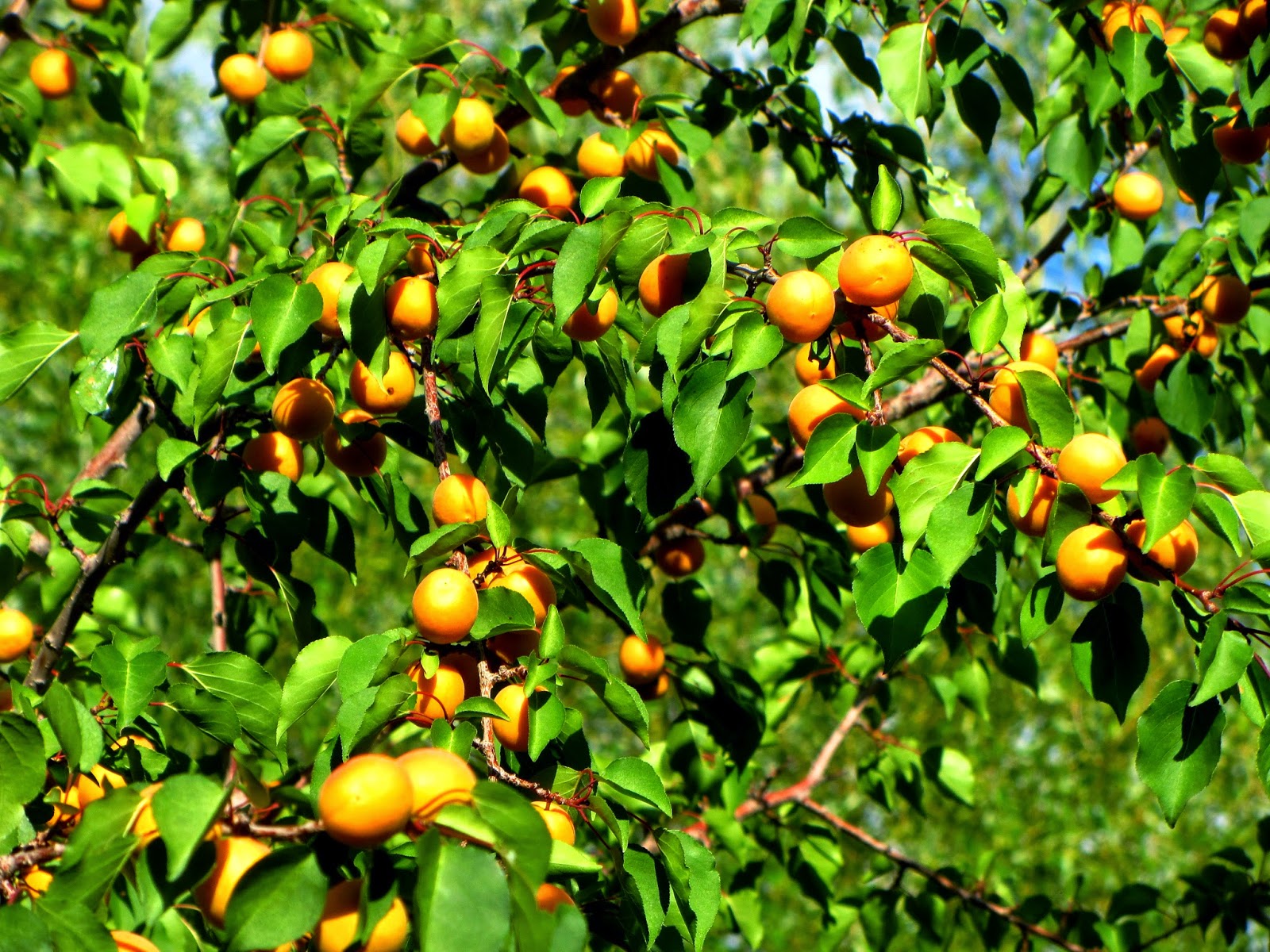
It was past 4 pm when we reached Diskit after travelling the whole day. The long route was excuisitely beautiful and very sparesely populated which adds to the beauty of the place. Karakorum Range I saw for the first time and its formations are distinctly different from the Himalaya. Its much more rugged and has strange colours and rock formations some of the glimpses can be seen in the uploaded photos. We had some tea and provisions were lifted from Diskit market since our destination Hunder is a much smaller place. We saw the Diskit Monastory from a distance only. Again we proceeded further ahead for Hunder and was feeling quiet excited for the cold desert by this time. We went straight there to see white sand desert and two humped bactrian camels. The road leading to under from Diskit lies along Shyok River and then white sanded desert. The forms of the sand dunes changes its shape and size and design with time due to strong wind flow! Hence the nature of it we saw during our ongoing journey varied from that seen during returning!        I was awe struck with the beauty and uniqueness of the whole scenery. The rock formations of the Karakorum is extremely striking! After getting soaked in the bauty of the place to the fullest extent we started for our hotel at Hunder and when we reached there all of us were thrilled to see the hotel. If I just say its bautiful nothing can be understood because its actually the whole ambience of the place starting from a fantastic flowers, fruits and kithcen gardens surrounding the two story small structure and the back drop of rugged wall like mountains and poplars and wheat fields surrounding the hotel... its simply divine something! Apples and Apricots trees were looking so tempting with full of ripe fruits. The view from our room was simply awesome with steep stark naked rocky mountain standing like wall just out side our window crossing the boundary of the hotel. It was full moon night and we couldn't sleep because of moonlight like molten silver flooded our room! It was a most romantic spot, moment and place to remember and cherish life long. 
view from our hotel room...wheat field with full harvest in the foreground
.jpg) .jpg)
just beyond our window!!!
Chortens at Hunder.....
 
Ladakhi women eagerly waiting for the Head Lama... .in their traditional festive attire!!!

sand dunes @ Hunder...for miles n miles..of white sand ....
We started for the model village Turtuk of Baltistan next morning after break fast. The road is all along by the side of Shyok river. This village became a part of India only after war of 1971 from pakistan along with four other village of Baltistan. Its about 80 kms from Hunder. Even Indians of other parts of India were not allowed to visit this village till 2010! LOC is walkable distance from here but one can't go there! After we travelled through rugged and without any trace of human dwellings throught the route this village appeared to be a sudden burst of green which always signifies life. We were greeted by merry shouts of a bunch little naked boys who were frolicking in the ice cold spring coming from the glacier and flowing down to the Shyok by the side of the hamlet. A picture perfect wooden hanging bridge welcomed us. Now green is the colour which you will see all around as if by some magic touch evrything has turned into life! I felt so happy. We finished our lunch and then the local villager Karim Bagdour narrated us about the history and geography of this unique place. Then we went to guided tour with him. Everything appeared to me to be fascinating. The local people there are Baltic in race and speak that language only. This language is only spoken and can't be written!!! They are Muslims unlike other places of Ladakh where majority are Budhhists. It is claimed that these people's ancestors came from Greece and hence lies the secret of their unusual good looks and blue eyes. This village was part of encient Yagbo Dynasty (800 to 1400AD) of Baltistan. The heir of the dynasty Yagbo Modh Khan lives here and in his modest humble way is trying to showcase that dynasty's few artifacts of the KIngs in his personal museum at the residence. A family tree of the dynasty is also there. Karim took us to his place and he explained and showed us proudly the things and stories of his ancestors.
This little girl under the tree with hand made tandoor breads and tea for some reasons made me remeber Pari of Khaled Hosseini in "The Mountain Echoed.." In fact while taking the tour in this village for some reason I repeatedly remembered the various stories of Khaled Hosseini!!!
  
K2 peeping ...the only place in India from where you can see the World's second highest peak!!!

Shyok river beside Turtuk.....
We started the village tour through the cobbled stoned path layed along the village dweelings and saw just like the Indus Civilisation nice arrangement of flowing water from springs through well made channels throughout the village in front of every house. Beatiful looking women and girls were doing their household chores in front of every home in that ice cold water coming from glaciers just like running water! Its a simple but fantastic arrangement. The village is strewn with apple, apricot, grapes and walnut trees all of which are full with ripe crops this being the right season. Karim took us to the hydraulically oprated wheat grinder. Wheat is fried before grinding. The village is unusually fertile compared to its surrounding places with absoltuly dry and arrid Karakorum mountain ranges. Various kinds of green vegetables like cabbage, cauliflower, capsicum, raddis, carrots, many leafy green vegetables are found in abundance in the fields. The best apricots of the country is available here and dried apricots are exported from here Five varieties of apricots are harvested here. Wheat and other serials are cultivated in abundance. This is the only place in the country from where you can see the second highest mountain peak of K2 which is about 100 kms from here. And POK is walkable distance. The guide Karim is a great entrepreuner in that distant remote village which does not even have a high school! He appeared to be the Prince Charmng of Turtuk, the dreamland. All the girls, women, elders, kids have something nice to share with him. He is the owner of the only grocery of the village where you can get even bottled mineral water and soft drinks even. He is also the owner of a home stay with nice, cosy, humble rooms with bed, dinner and breakfast for meagre five hundred rupees per head. It was a pleasure to know him. After the tour we decided to come to this serene and beautiful place away from all hubble bubble of human civilisations once more and stay there for a few days leisurely at his home stay!
When we started our way back to Hunder it left a splendid parmanent memory in our mind!
I forgot to tell you about the awesome full moon night at Hunder. Everything surrounding us appeared to be unnatural in that strong silvery light. The mountains just beyond our plane glass windows looked ethereal in its beauty! After spending two beautiful nights at this awesome place we again proceeded for Leh early morning after breakfast.
The way to Shia Cheen glacier falls along this route but only military is allowed to go in that route and none else. From the diversion point its about 60/70 kms. The Shyok river also comes from the same glacier.
Coming back to Leh the same day in the afternoon we visited Thiksey Monastory, Shey Palace and Sindhu Ghat where the festivals are held. You wont miss anything if you give give a miss to the last one I mentioned. But Thiksey is a place worthy of visit. The monastery is located at an altitude of 3,600 metres (11,800 ft) in the Indus valley. It is a 12-storey complex and houses many items of Buddhist art such as stupas, statues,thangkas, wall paintings and swords. One of the main points of interest is the Maitreya (future Buddha) Temple which is installed to commemorate the visit of the 14th Dalai Lama to this monastery in 1970. A 15 metres (49 ft) high statue of Maitreya, the largest such statue in Ladakh, covering two storeys of the building is deified in the monastery. A nunnery is also part of the complex. It also houses a library of encient books! A huge silver lamp appeared to me to be quite interesrting.
.JPG) .JPG) .JPG) .JPG) .JPG) .JPG) .JPG) 
Thiksey from far off
.JPG)
Shey Palace and Monastory
.JPG)
Beautiful and huge Copper Lamp @ Shey
|
.JPG)


.JPG)
.JPG)
.JPG)
.JPG)
.JPG)


Subscribe to:
Posts (Atom)